Today was an event filled day, with some things that went exactly as planned and others that seemed to evolve as we went along but turned out spectacularly well.
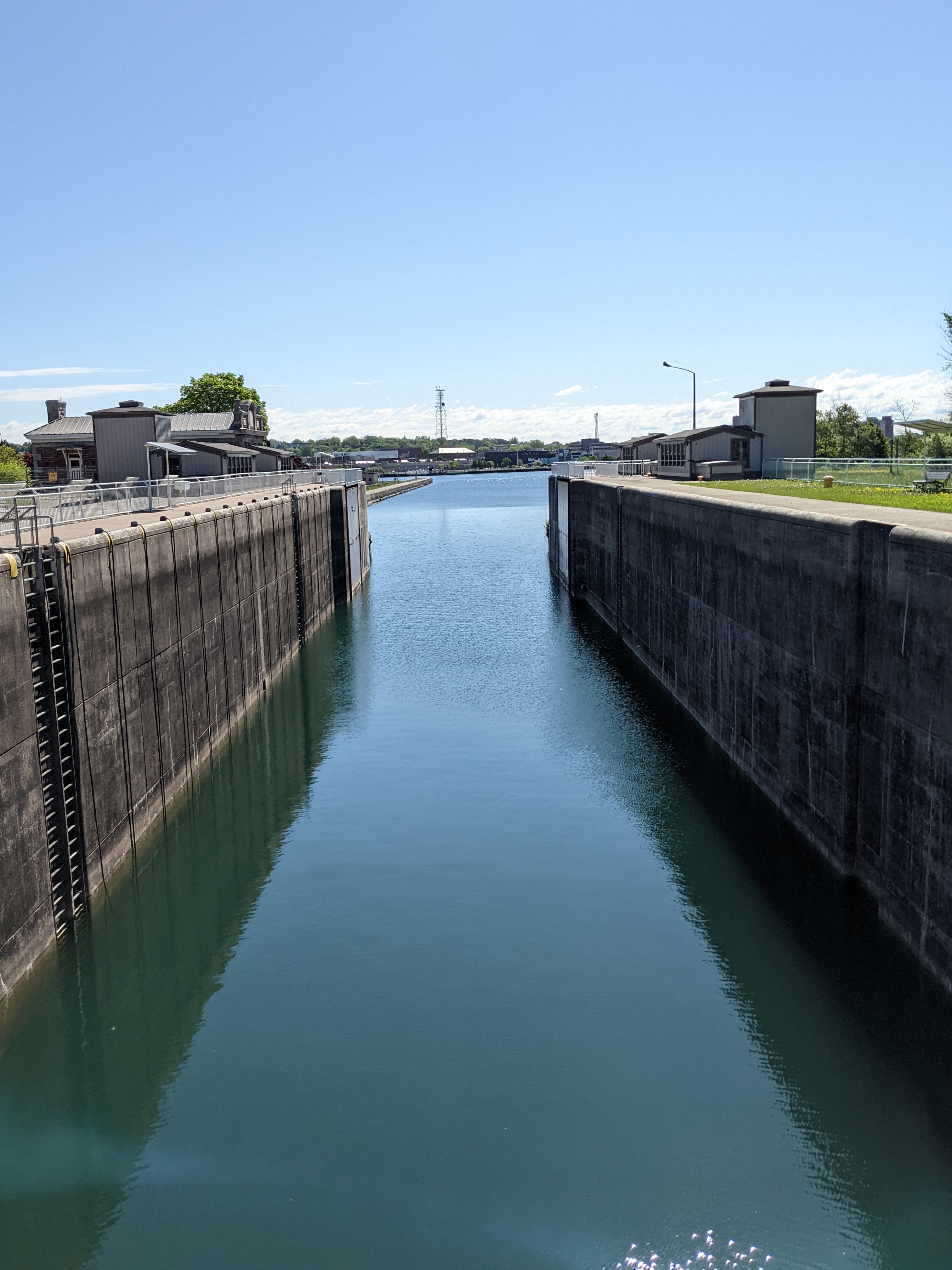
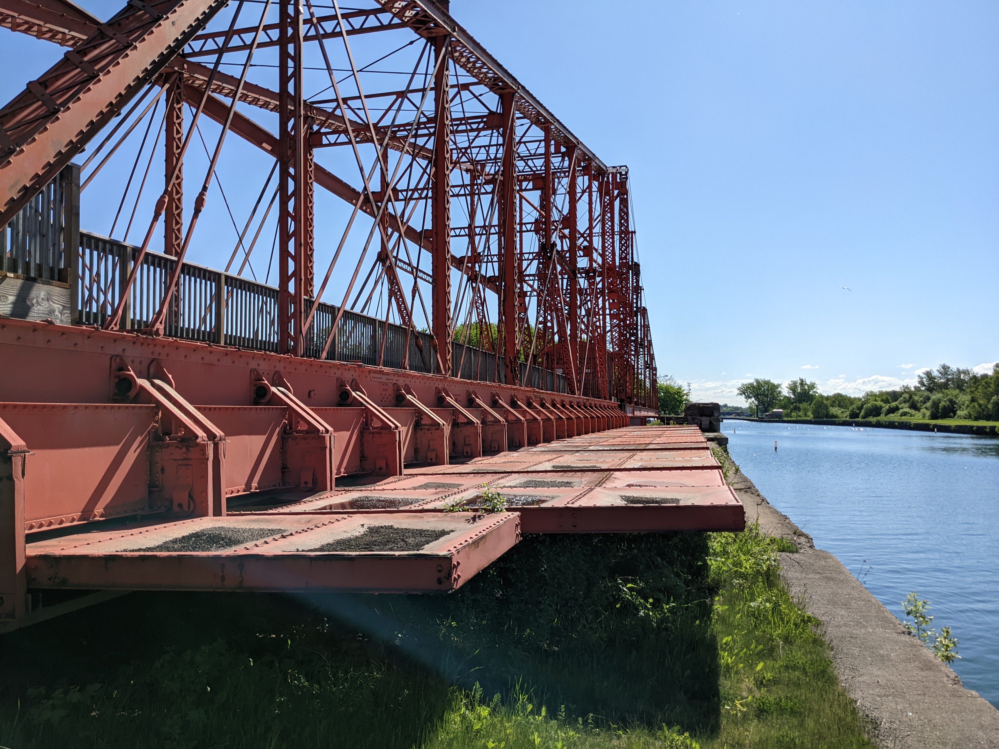
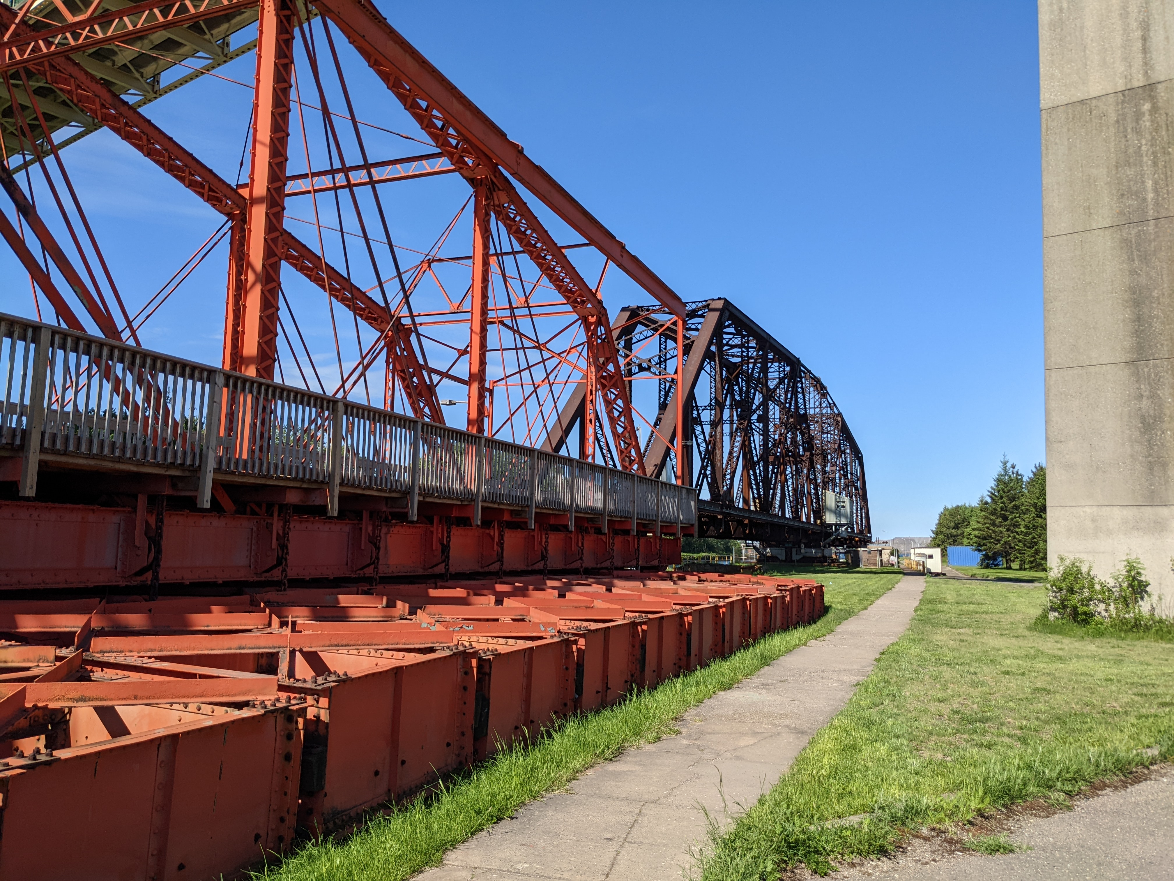
We started by exploring the waterfront, walking on the boardwalk along St. Mary’s river towards the Historic Canal and Lock area. It was all really quite impressive, but what made it more so was when a gentleman who was walking his dog stopped to talk. He told us about a special emergency swing dam that was built for the locks and used once when a boat crashed into the locks in 1909. It was deployed in order to halt the water rushing into the now broken locks, saving the areas of the town. Apparently of 9 built around the world, this was the only one that was ever deployed. It is still on site so we were able to walk down and look at this feat of engineering.
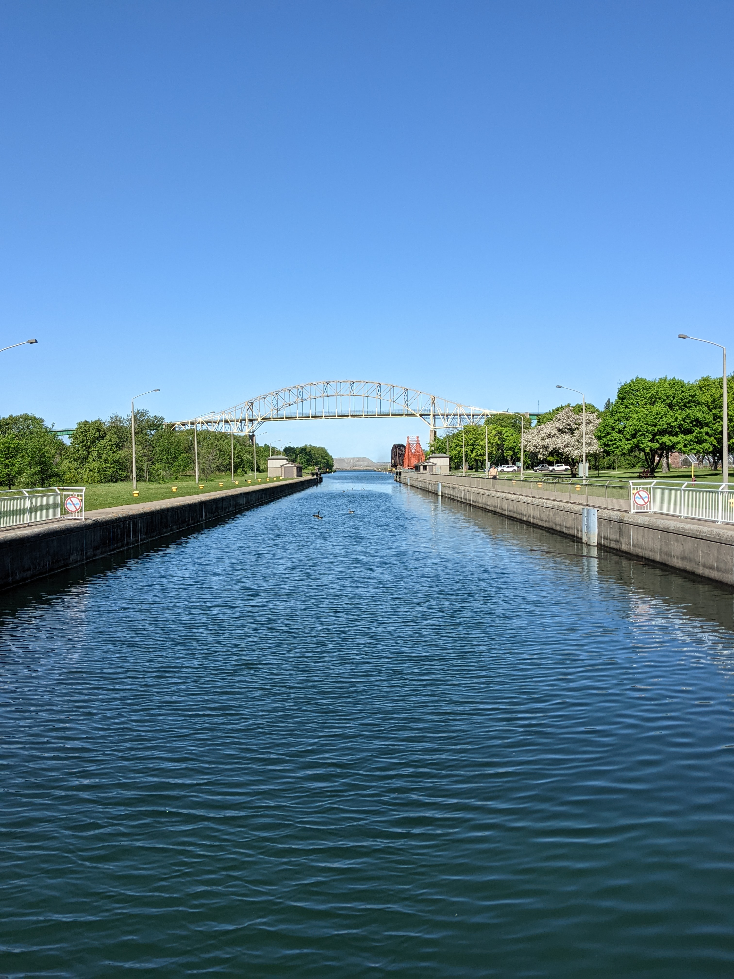
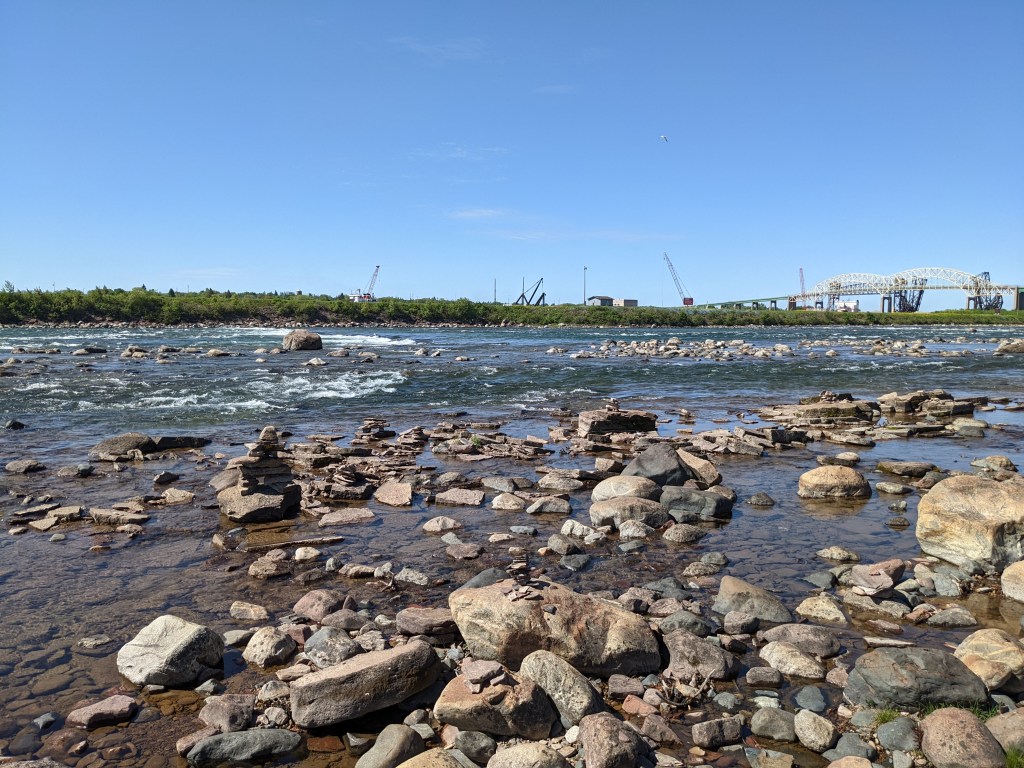
He also directed us to cross the canal and find the hiking paths on Whitefish Island. It turns out the island is a historic site as it was a traditional fishing settlement and is part of the Batchawana First Nations territory. There are lovely trails passing beaver dams and through dense brush, which eventually come out at the river, giving us our first view of the St. Mary’s rapids. It was these rapids that the voyageurs had to portage around on their way to and from Lake Superior, and eventually the locks were built to facilitate ship traffic.
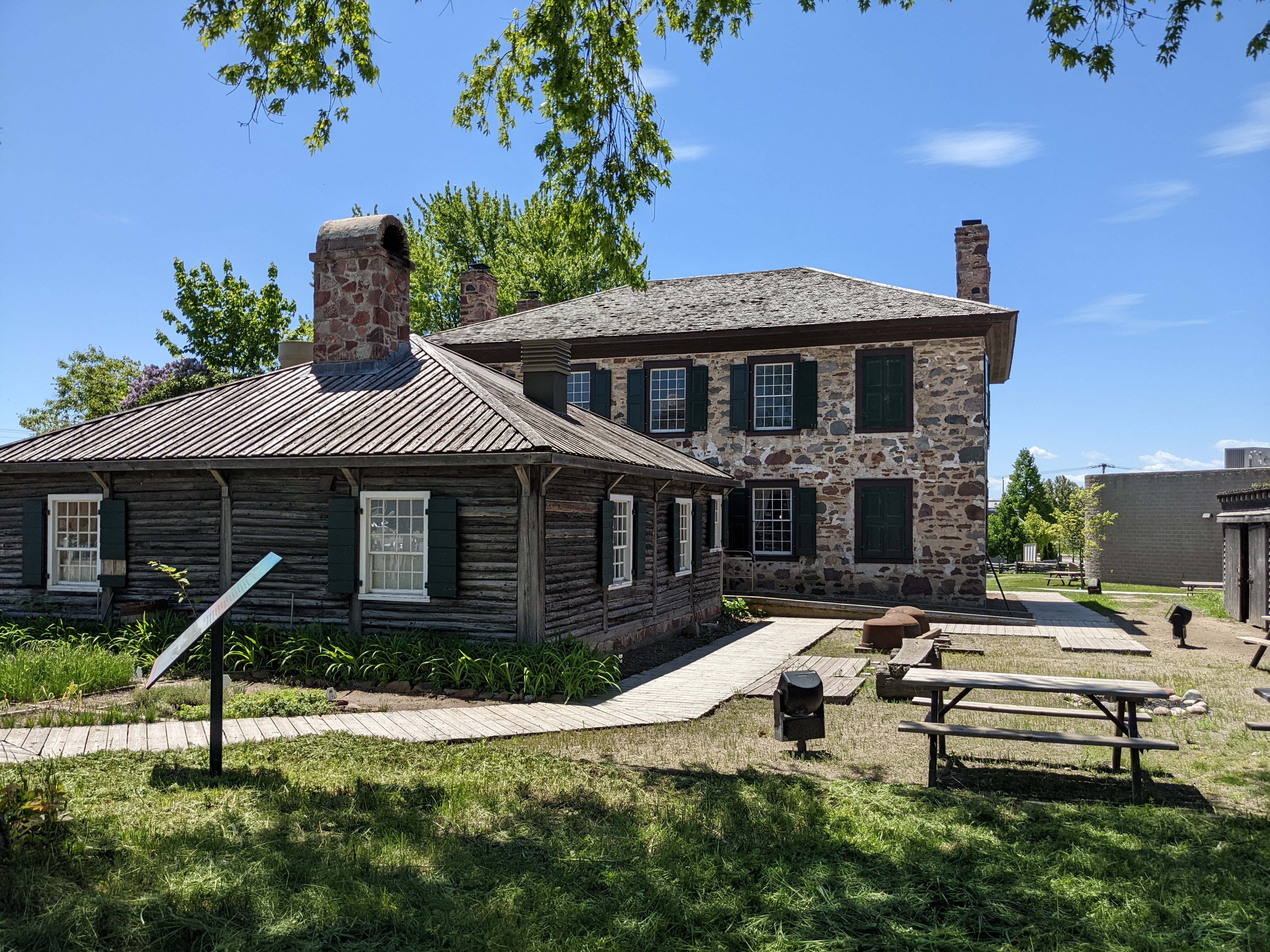
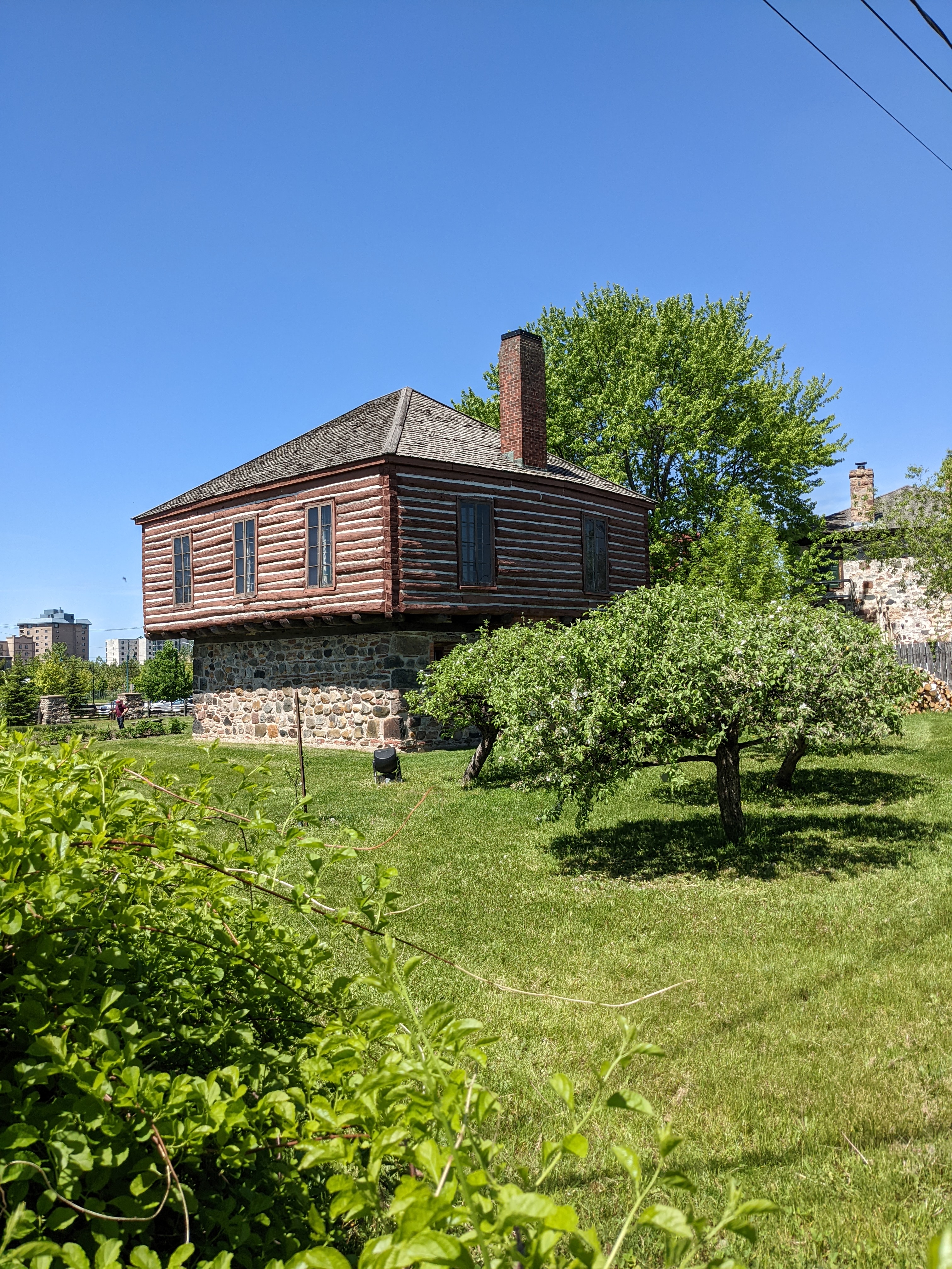
Next up was a visit to the Ertaminger Clergue historic site which combines the original stone house of Charles Ertaminger who was an important business man and fur trader in Sault Ste. Marie around the time of the War of 1812 and onwards. I recently re-read the book The Voyaguers by Margaret Elphinstone and in this book the stone house overlooking the river is being built. The unique Clergue house has been moved to this same site, and is from a later time but was built around an old powder magazine, so the lower level is stone with a larger log structure built on top.
Next on the agenda was a visit to the Canadian Bushplane Heritage Centre which is a large hanger full of beautifully restored planes that were invaluable in this area for transport but also very important for fire spotting and fire fighting. There was also a well done video on the subject, narrated by Gordon Pinsent.
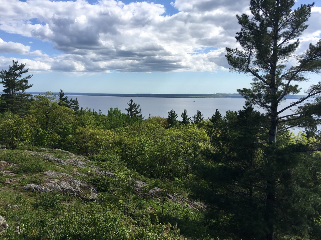
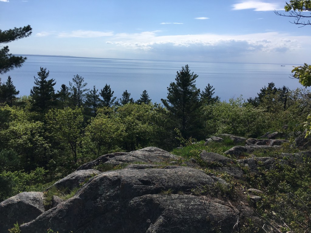
The latter part of the day was a bit more adventurous as I had read about a viewpoint just outside Sault Ste. Marie that would give us our first view of Lake Superior. We headed out to Gros Cap which according to Google Maps was a bluff, so we expected this to be the right place. We found it easily enough, but the view was definitely not from any bluffs. So we went exploring quite a bit further, up and down some dirt roads, only to encounter a ‘private road, no trespasssing sign’ right when we though we were getting close. We parked the car and followed a hiking trail away from the restricted area, and suddenly there it was, a spectacular view of Whitefish Bay and Lake Superior from the top of the bluffs. What a site!
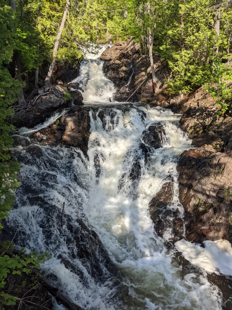
But there’s more. We hunted down Crystal Falls waterfall described as being in Kinsmen park, which was unmarked and down dirt roads, but it was mentioned in our Waterfalls of Ontario book. No signage at all but we found it, and it was very impressive indeed with several layers of rushing water, all quite accessible from a boardwalk wtih carefully fenced viewing areas.

Enjoying your travels.
LikeLike